| Well Information Table |
|---|
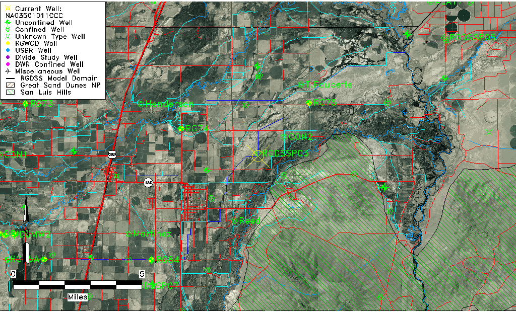
| Common Well ID | NA03501011CCC |
| USGS Station Name | NA03501011CCC |
| USGS Site Type | NNNNNYNNNNNNNNNNNNNN |
| USGS Site Use Information | Unknown |
| USGS Groundwater Use Information | Unknown |
| Data Source(s) | USGS |
| Location Data |
|---|
| TRS | NA03501011CCC |
| USGS TRS 1 | NA03501011CCC |
| Longitude/Latitude (NAD83) | -105.85555556 , 37.28361111 |
| Longitude/Latitude Data Source | GWSI decimal LAT/LONG field |
| USGS Longitude/Latitude (NAD83) | -105.855555556 , 37.283611111 |
| Easting, Northing RGDSS-NAD83 (US ft) | 147217.45 , 104797.81 |
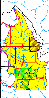
| USGS County | Conejos County |
| USGS Map Name | PIKES STOCKADE |
| USGS Map Scale | 24000 |
| Elevation and Depth Data |
|---|
| Ground Elevation (ft NAVD88) | 7555.91 |
| Elevation Data Source | USGS GWSI database |
| USGS Ground Elevation (ft NGVD29) | 7552.00 |
| 1/3-Arc Second NED Ground Elevation (ft NAVD88) | 7564.61 |
| 1-Arc Second NED Ground Elevation (ft NAVD88) | 7564.60 |
| SRTM Ground Elevation (ft NAVD88) | 7568.90 |
| Total Depth (ft) | 720.00 |
| USGS Well Depth (ft) | 720.00 |
| Model Layer | 4 |
| Model Layer Source | Well Depth |
| Depth of Bottom of Layer 1 | 24 |
| Depth of Bottom of Layer 2 | 262 |
| Depth of Bottom of Layer 3 | 597 |
| Depth of Bottom of Layer 4 | 1922 |
| Additional Well Information | NONE |
| Aquifer Information |
|---|
| Aquifer Type | Confined |
| Aquifer Type Source | TD Elevation/Model Layer |
| USGS Aquifer Type | Confined Single Aquifer |
| Water-level Database Information |
|---|
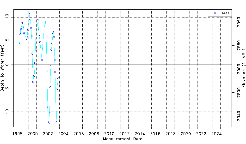
| Water-level Count | 49 |
| Water-level Date Range | 10/22/1998 thru 10/21/2003 |
| Monitored within the last 18 months | No, most recently on 10/21/2003 |
| Depth-to-Water Range (ft) | -10.90 to 12.35 |
| Water Table Elevation Range (ft NAVD88) | 7543.56 to 7566.81 |
| Water-Level-Source:Number-of-Measurements | USGS:49 |