| Well Information Table |
|---|
| Common Well ID | Pig Well |
| CWCD Well Name | Pig Well |
| USGS Site Use Information | Unknown |
| USGS Groundwater Use Information | Unknown |
| Data Source(s) | DWR, CWCD |
| Location Data |
|---|
| TRS | Pig Well |
| Longitude/Latitude (NAD83) | -105.97432700 , 37.07934200 |
| Longitude/Latitude Data Source | Conejos WCD |
| Easting, Northing RGDSS-NAD83 (US ft) | 112438.10 , 30532.73 |
| Elevation and Depth Data |
|---|
| Ground Elevation (ft NAVD88) | 7829.32 |
| Elevation Data Source | NED3 data |
| 1/3-Arc Second NED Ground Elevation (ft NAVD88) | 7829.32 |
| 1-Arc Second NED Ground Elevation (ft NAVD88) | 7828.44 |
| SRTM Ground Elevation (ft NAVD88) | 7831.03 |
| Depth of Bottom of Layer 1 | 34 |
| Depth of Bottom of Layer 2 | 144 |
| Depth of Bottom of Layer 3 | 273 |
| Depth of Bottom of Layer 4 | 1590 |
| Additional Well Information | NONE |
| Aquifer Information |
|---|
| Aquifer Type | Confined |
| Aquifer Type Source | CWCD_AQFR |
| Water-level Database Information |
|---|
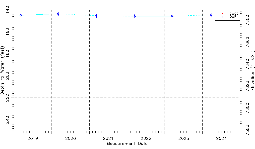
| Water-level Count | 742 |
| Water-level Date Range | 02/27/2015 thru 03/26/2024 |
| Monitored within the last 18 months | No, most recently on 03/26/2024 |
| Depth-to-Water Range (ft) | 140.92 to 249.28 |
| Water Table Elevation Range (ft NAVD88) | 7580.04 to 7688.40 |
| Water-Level-Source:Number-of-Measurements | CWCD:732 DWR:10 |