| Well Information Table |
|---|
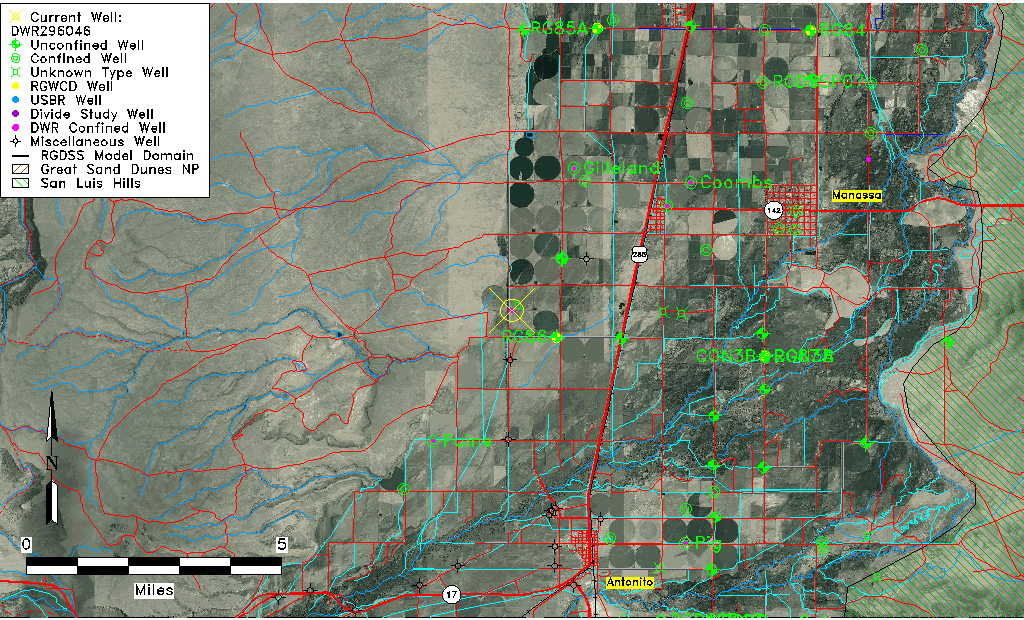
| Common Well ID | DWR296046 |
| USGS Site Use Information | Unknown |
| USGS Groundwater Use Information | Unknown |
| Data Source(s) | DWR |
| Location Data |
|---|
| Longitude/Latitude (NAD83) | -106.03604490 , 37.14518718 |
| Longitude/Latitude Data Source | DWR Confined |
| DWR Longitude/Latitude (NAD83) | -106.0360449 , 37.14518718 |
| Easting, Northing RGDSS-NAD83 (US ft) | 94529.57 , 54562.30 |
| Elevation and Depth Data |
|---|
| Ground Elevation (ft NAVD88) | 7837.65 |
| Elevation Data Source | DWR data |
| DWR Confined wells (ft NAVD88) | 7837.65 |
| 1/3-Arc Second NED Ground Elevation (ft NAVD88) | 7837.83 |
| 1-Arc Second NED Ground Elevation (ft NAVD88) | 7837.70 |
| SRTM Ground Elevation (ft NAVD88) | 7846.17 |
| Depth to Top of Screen (ft) | 170.0 |
| Depth to Bottom of Screen (ft) | 258.00 |
| Model Layer | 3 |
| Model Layer Source | DWR |
| Depth of Bottom of Layer 1 | 59 |
| Depth of Bottom of Layer 2 | 134 |
| Depth of Bottom of Layer 3 | 205 |
| Depth of Bottom of Layer 4 | 1113 |
| Additional Well Information | NONE |
| Aquifer Information |
|---|
| Aquifer Type | Confined |
| Aquifer Type Source | TD Elevation/Model Layer |
| Water-level Database Information |
|---|
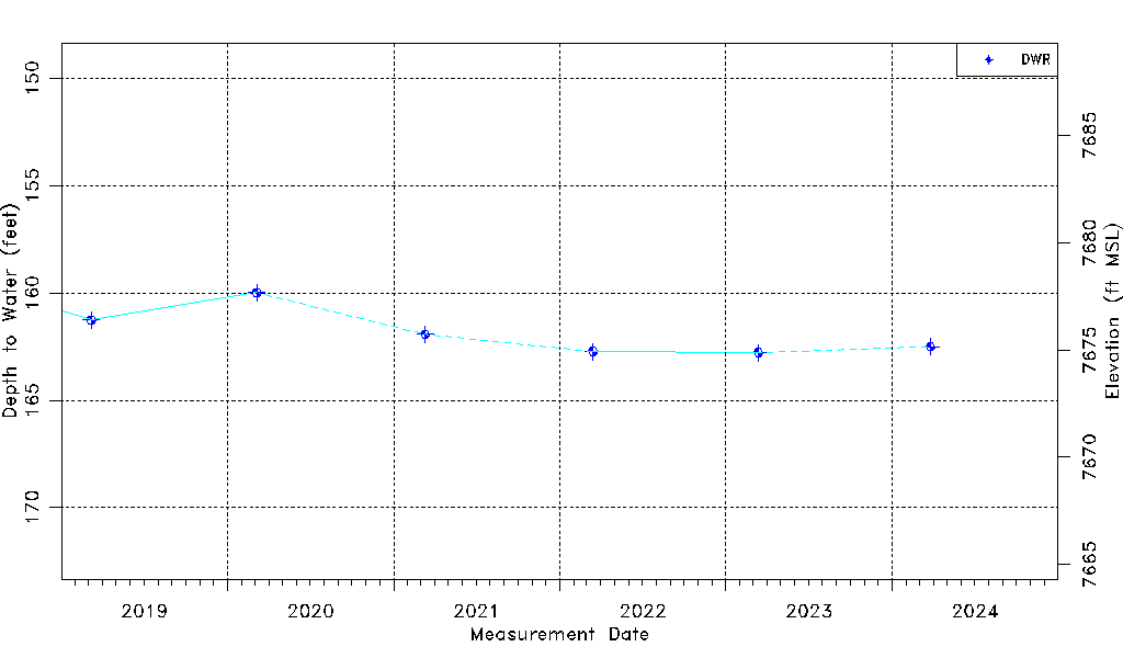
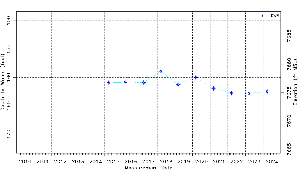
| Water-level Count | 10 |
| Water-level Date Range | 03/29/2015 thru 03/26/2024 |
| Monitored within the last 18 months | No, most recently on 03/26/2024 |
| Depth-to-Water Range (ft) | 158.91 to 162.78 |
| Water Table Elevation Range (ft NAVD88) | 7674.87 to 7678.74 |
| Water-Level-Source:Number-of-Measurements | DWR:10 |