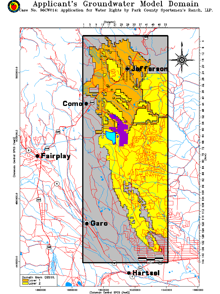
The Applicant's groundwater model domain is shown below. The model consists of five layers. Layers one and two which are the top two layers in the model are shown in orange and yellow, respectively. The area shown in grey is within the model boundaries but not part of the model. The model extends 144000 feet (27.27 miles) north to south and 54000 feet (10.23 miles) east to west. Model cells measure 1000 feet on a side.
The towns of Como, Garo, Fairplay, Hartsel and Jefferson are indicated on the map. The Sportsmen's Ranch is shown in purple, while the surface reservoir proposed as part of the projects is shown in blue.
On other maps shown on this web site, only the modeled area is shown.